
The history of Abbey Wood Hospital on Page Street, Mill Hill stretches back more than two centuries. Long before it became one of North London’s most trusted private hospitals, the building and its grounds held a rich, layered past. It grew from a modest Georgian villa with ornamental pleasure grounds into a listed building of local architectural significance. This article draws on historic maps, Ordnance Survey records, and documents from the London Metropolitan Archives to trace that journey from the earliest origins to the present day.
In This Article
Origins: Abbey Wood in the 18th Century
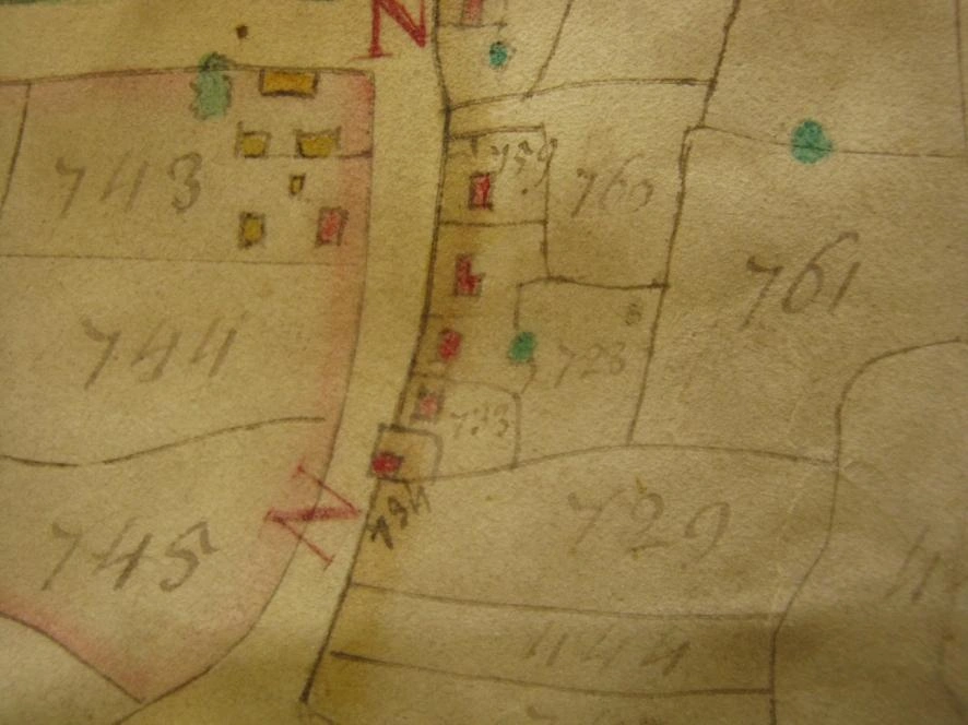
To understand the history of Abbey Wood, we must go back to 1754. A plan of the manor and parish of Hendon from that year gives us the earliest record of the site. At that time, two roughly rectangular plots of land sat beside Page Street, with a building set a short distance back to the west. A circular pond already occupied the centre of the plot. Quarrying activity likely formed it, as several similar features appeared across the area. Notably, the boundary arrangement visible on this 1754 plan stayed broadly consistent across centuries of later mapping.
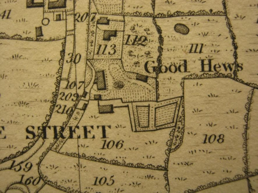
By 1828, cartographers produced a more detailed map of the manor and parish of Hendon. It depicts the buildings along Page Street with greater accuracy. Furthermore, the building within the site now carried the name Good Hews — later linked to Good Hews Farm to the north. A curving carriage drive swept the full width of the plot and met a prominent porch at the front. Additionally, two small structures at the southern end of the drive likely served as a coach house or stables.
A Georgian Pleasure Ground Takes Shape
The 1840 tithe map for Hendon Parish gives us the first definitive picture of the site as Abbey Wood — the name it carries today. The map shows the building in a cruciform plan, sitting in the northwest of the site. The apportionment records the plot as a dwelling house, outbuildings, and pleasure ground.
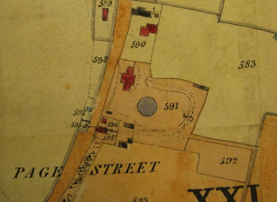
The garden at this period drew on fashionable Georgian design thinking. Gardeners reworked the earlier circular pond into a perfect circle, turning it into a focal point. A perambulation path swept around it, and planting of shrubbery and trees along the garden edges created enclosed, woodland-glade experiences. Moreover, a garden structure in the northeast corner gave walkers a destination to head towards.
The front of the property, meanwhile, looked westward over the parkland of Copt Hall. This was a deliberate borrowing of the wider landscape — a technique that William Kent championed during the Georgian era. In addition, a walled kitchen garden sat to the south, screened from the pleasure grounds by shrubberies.
The Victorian and Edwardian Estate
The first edition Ordnance Survey of 1873 confirmed the 1840 layout and added more detail. Shrubs and coniferous trees filled the central garden area east of the pond. Similarly, a band of deciduous trees ran along the northern, eastern, and southern boundaries. To the south, a kitchen garden and rectangular orchard occupied the walled enclosure. Coniferous trees, furthermore, flanked the front façade and kept the westward views open.
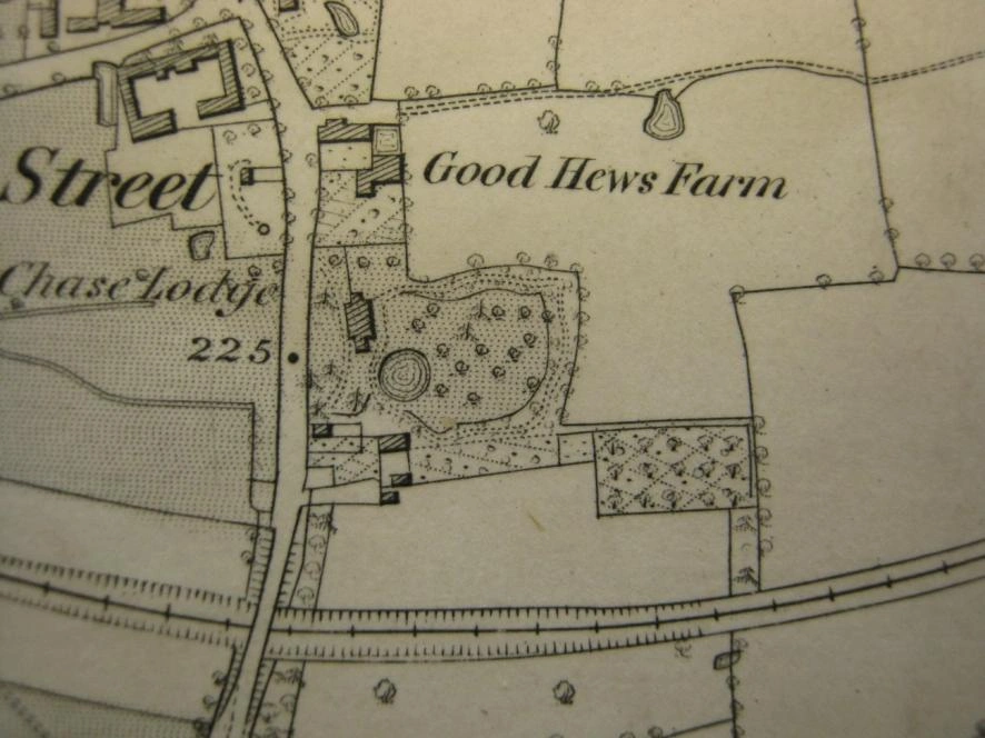
By 1892, the history of Abbey Wood entered a more elaborate chapter. Builders added several glasshouses across the site. One went up in the northeast where an earlier outbuilding had stood. Another adjoined the rear of the south wing. A further set edged the former walled garden, which the owners likely ran as a nursery by this point.
In addition, a new plantation of deciduous trees went in across the road. As a result, it blocked the formerly open view towards the Copt Hall estate — a significant change to the character of the setting.
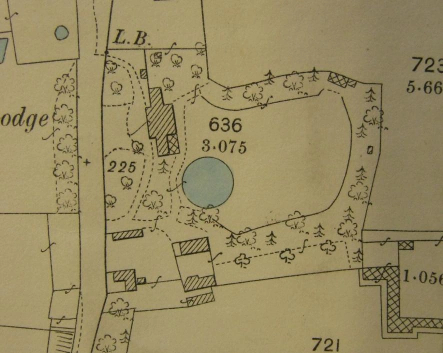
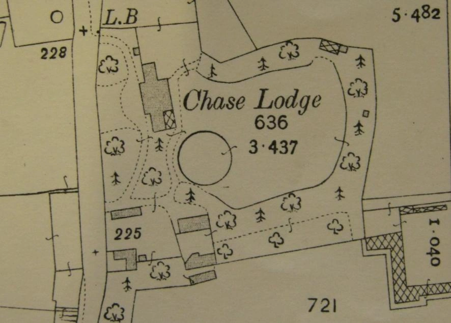
The 1914 Ordnance Survey, however, showed no significant changes to the garden’s design. The trees at the front of the property had grown more established. The central lawn to the rear remained open, still framed by its mature wooded boundary belt.
The 20th Century: Change and Decline
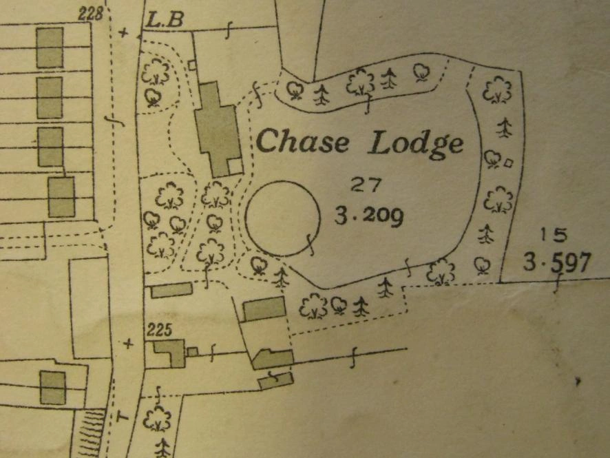
The next chapter in the history of Abbey Wood brought significant simplification. The 1932 and 1935 Ordnance Survey editions record workers clearing every glasshouse from the site. They also removed the former orchard, nursery, and walled garden to the south entirely. Throughout the Victorian era, the estate had grown steadily more elaborate. Now, however, owners were stripping it back.
Surveyors visited the grounds in the 1960s ahead of redevelopment for sports use. Two bands of trees still stood along the north and west of the rear plot. The survey also named a single Weeping Ash by species. Photographers captured the building and grounds during this period too. The London Metropolitan Archives hold that collection today.
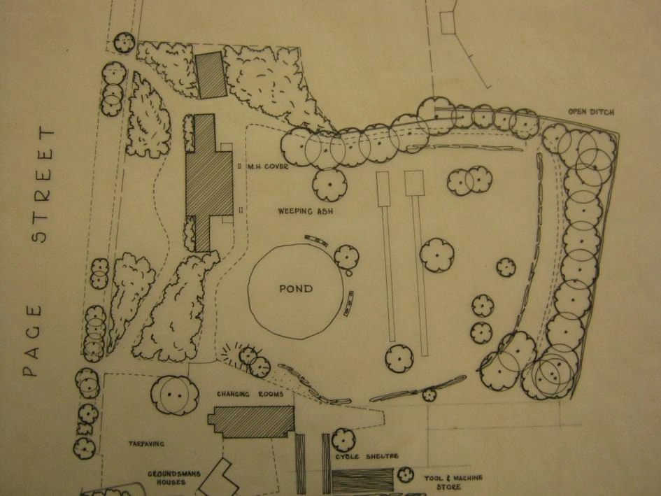
The 1960s photographs offer a vivid glimpse of the grounds during the restoration period. Views from the southeast, for instance, show the pond, a tended lawn, a tall coniferous tree, and shorter deciduous planting closer to the house.
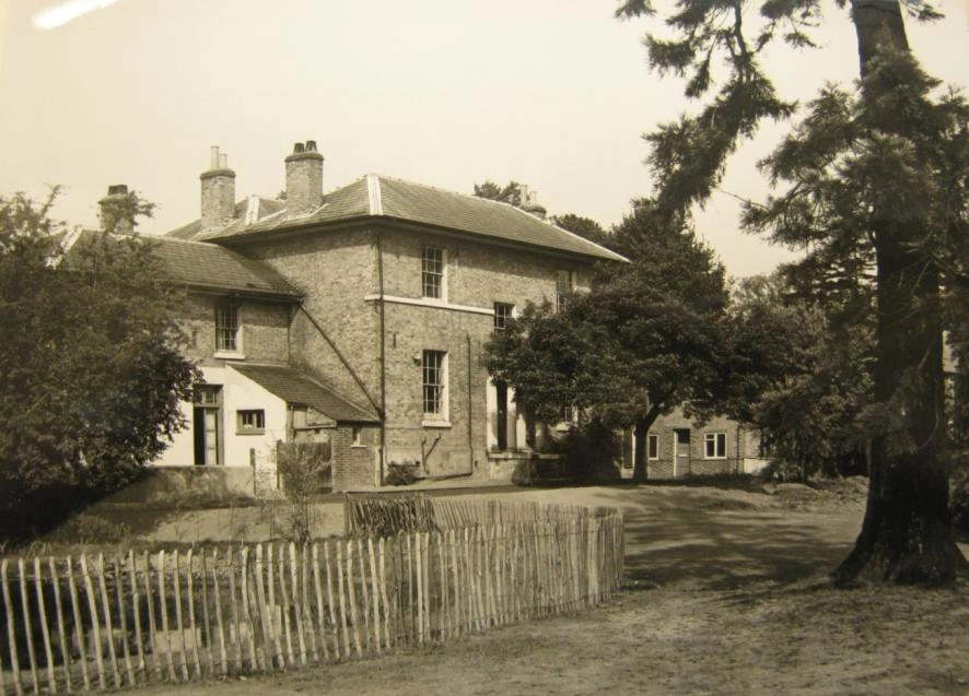
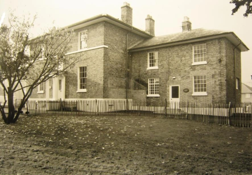
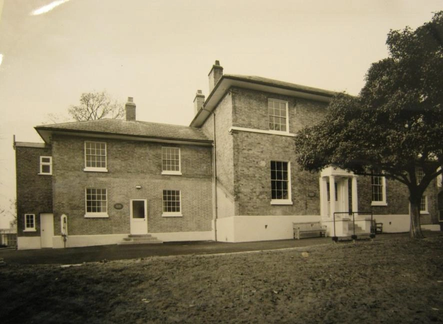
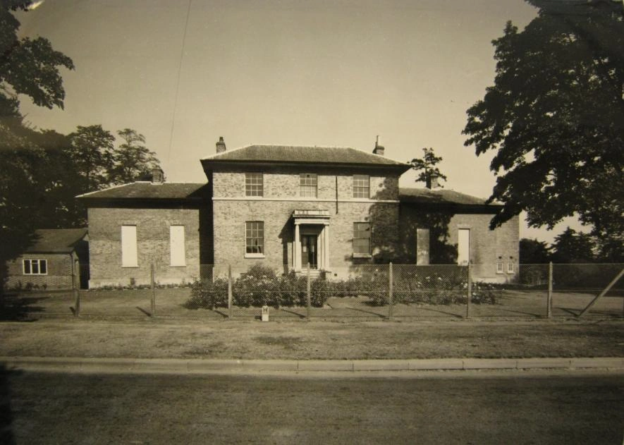
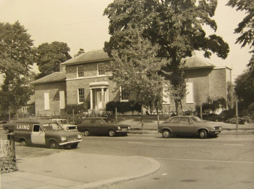
By the 1970s, a high mesh fence with concrete posts enclosed the front of the property. This reflected its shift towards institutional use. Nevertheless, tall deciduous trees still stood within the grounds. A possible rockery to the southwest, furthermore, hinted at the ornamental character that had defined the estate for generations.
Abbey Wood Today
Today, the history of Abbey Wood lives on in its landscape. In recent years, however, the former pleasure ground has shrunk to nearly half its original size. The circular pond that once anchored the historic garden design has grown into a wooded copse. The perimeter belt of trees has also thinned within the current landholding. A substantial section does survive — though it now lies within Abbey Wood Playing Fields, just beyond the eastern boundary.
Despite these changes, visitors can still read the underlying framework of the Georgian pleasure ground in today’s landscape. The sweeping front drive, the mature tree arrangement, and the relationship between the listed building and its grounds all carry traces of the original design.
A heritage landscape appraisal by ECUS Ltd confirmed that the site retains enough historic character to support a meaningful landscaping strategy. Consequently, sympathetic development could serve to re-anchor the building to its historic surroundings.
As a leading private hospital in North London, Abbey Wood Hospital continues to serve the local community from a building that has stood at the heart of Mill Hill for more than two hundred years. To find out more about our services or to book an appointment, visit our booking page or call 020 8358 7100.
Frequently Asked Questions
When was Abbey Wood built?
The site has records going back to at least 1754, when it first appears on a plan of the manor and parish of Hendon. The 1840 tithe map for Hendon Parish definitively records the building as Abbey Wood in a cruciform plan. It holds listed building status, recognising its local architectural significance.
What was Abbey Wood originally used for?
Abbey Wood began as a private Georgian villa within ornamental pleasure grounds. Historic records describe the plot as a dwelling house, outbuildings, and pleasure ground. The surrounding estate also included a walled kitchen garden, an orchard, glasshouses, and a network of serpentine and circuit paths typical of Georgian garden design.
Where is Abbey Wood Hospital located?
Abbey Wood Hospital sits on Page Street, Mill Hill, London NW7 2ED — the same address the building has held for over two centuries.
Is Abbey Wood a listed building?
Yes. Abbey Wood holds listed building status, which recognises its architectural and historic importance. Its history and grounds have therefore been the subject of a formal heritage landscape appraisal to guide ongoing development and conservation.
What happened to the historic gardens at Abbey Wood?
The ornamental pleasure grounds once featured a circular pond, walled kitchen garden, glasshouses, and a perimeter circuit walk. However, the 20th century brought gradual simplification. The former pond has recently been rehabilitated and is now teeming with fish, and much of the original garden lies within Abbey Wood Playing Fields.The underlying framework of the Georgian design, nevertheless, remains visible in the landscape today.
Historic information in this article draws from a landscape appraisal prepared by ECUS Ltd on behalf of Abbey Wood Hospital, based on maps and records held at the London Metropolitan Archives. Images reproduced from LMA archive sources for historical reference.